


10-2 DuPont Community Center Voting District, Sevier County, Tennessee
About
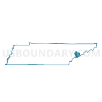
Outline

Summary
| Unique Area Identifier | 669518 |
| Name | 10-2 DuPont Community Center Voting District |
| County | Sevier County |
| State | Tennessee |
| Area (square miles) | 28.81 |
| Land Area (square miles) | 28.81 |
| Water Area (square miles) | 0.00 |
| % of Land Area | 100.00 |
| % of Water Area | 0.00 |
| Latitude of the Internal Point | 35.83037840 |
| Longtitude of the Internal Point | -83.69233440 |
Maps


Graphs
Select a template below for downloading or customizing gragh for 10-2 DuPont Community Center Voting District, Sevier County, Tennessee


Neighbors
Neighoring Voting District (by Name) Neighboring Voting District on the Map
- 10-3 Adult H.S. (Whites) Voting District, Sevier County, TN
- 2-1 Waldens Creek Voting District, Sevier County, TN
- 4-1 Pigeon Forge City Hall Voting District, Sevier County, TN
- 9-1 Seymour Primary School Voting District, Sevier County, TN
- Oak View Voting District, Blount County, TN
- Walland Voting District, Blount County, TN
Top 10 Neighboring County Subdivision (by Population) Neighboring County Subdivision on the Map
- District 8, Blount County, TN (11,790)
- District 4, Sevier County, TN (10,279)
- District 10, Sevier County, TN (9,335)
- District 9, Sevier County, TN (7,089)
- District 2, Sevier County, TN (6,527)
Top 10 Neighboring Unified School District (by Population) Neighboring Unified School District on the Map
Top 10 Neighboring State Legislative District Lower Chamber (by Population) Neighboring State Legislative District Lower Chamber on the Map
Top 10 Neighboring State Legislative District Upper Chamber (by Population) Neighboring State Legislative District Upper Chamber on the Map
Top 10 Neighboring 111th Congressional District (by Population) Neighboring 111th Congressional District on the Map
Top 10 Neighboring Census Tract (by Population) Neighboring Census Tract on the Map
- Census Tract 804, Sevier County, TN (7,178)
- Census Tract 803, Sevier County, TN (5,315)
- Census Tract 113.02, Blount County, TN (5,290)
- Census Tract 802.02, Sevier County, TN (5,261)
- Census Tract 809.01, Sevier County, TN (3,397)
- Census Tract 114.01, Blount County, TN (1,778)